Log in
All resources
Create a design
453 Free Images of 17th Century Copper Engravings
copper engraving print
joan blaeu
british library
atlas maior, vol 5 (england) - joan blaeu, 1667 - bl 114.h(star).5
1667 maps
baroque
matthäus merian
17th-century maps of the spanish empire
engravings by matthäus merian
atlas maior, vol 12 (america) - joan blaeu, 1667 - bl 114.h(star).12
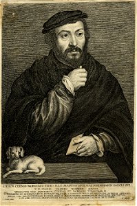
supposed images of matthias grünewald
german renaissance
jan diricks van campen
david kindt
mathematicians from denmark
priests from denmark
engravings by gérard edelinck
rococo
atlas maior, vol 2 (sweden, russia, poland, eastern europe, and greece) - joan blaeu, 1667 - bl 114.h(star).2
17th-century maps of finland
johann christoph neyffer
ludwig ditzinger
atlas maior, vol 1 (northern europe, norway, and denmark) - joan blaeu, 1667 - bl 114.h(star).1
1667 maps
17th-century maps of europe
latin-language maps
dominik ondřej kounic
1697 engravings
1660s maps of spain
1667 maps
johann theodor de bry
gaspard bauhin
maps by jodocus hondius
maps by petrus bertius
mikołaj radziwiłł the orphan
lucas kilian
madrid in the 1660s
louis meunier
carl gottlieb rasp
baroque painting
17th-century engraved oval portraits of men at bust length by dominicus custos
jerzy radziwiłł (cardinal)
engraved oval portraits of men at bust length
henri i de montmorency
carl gottlieb rasp
baroque painting
jena in the 17th century
baroque
1650s maps of bremen (state)
baroque
17th-century icons of belarus
žyrovickaja
17th-century icons of belarus
žyrovickaja
atlas maior, vol 4 (netherlands) - joan blaeu, 1667 - bl 114.h(star).4
1667 maps
1660s maps of spain
1667 maps
atlas van der hagen (volume 4)
atlas van der hagen
maps by jodocus hondius
copper engravings
quedlinburg in the 17th century
thesaurus philopoliticus
madrid in the 1660s
louis meunier
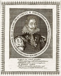
balthasar marradas
baroque
suecia antiqua et hodierna, volume 1
säby gård
engravings by matthäus merian
baroque
17th-century maps of the mediterranean sea
copper engravings
17th-century engraved oval portraits of men at bust length by dominicus custos
henri, duke of montpensier
copper engravings in the universitätsbibliothek salzburg
german renaissance,northern renaissance
maps in the library of congress
adriaen van der donck
bremen in topographia saxoniae inferioris (merian)
baroque
atlas van der hagen (volume 3)
atlas van der hagen
thuringia in the 17th century
baroque
engravings by matthäus merian
baroque
17th-century copper engravings
pax optima rerum
maps in the library of congress
adriaen van der donck
atlas maior, vol 1 (northern europe, norway, and denmark) - joan blaeu, 1667 - bl 114.h(star).1
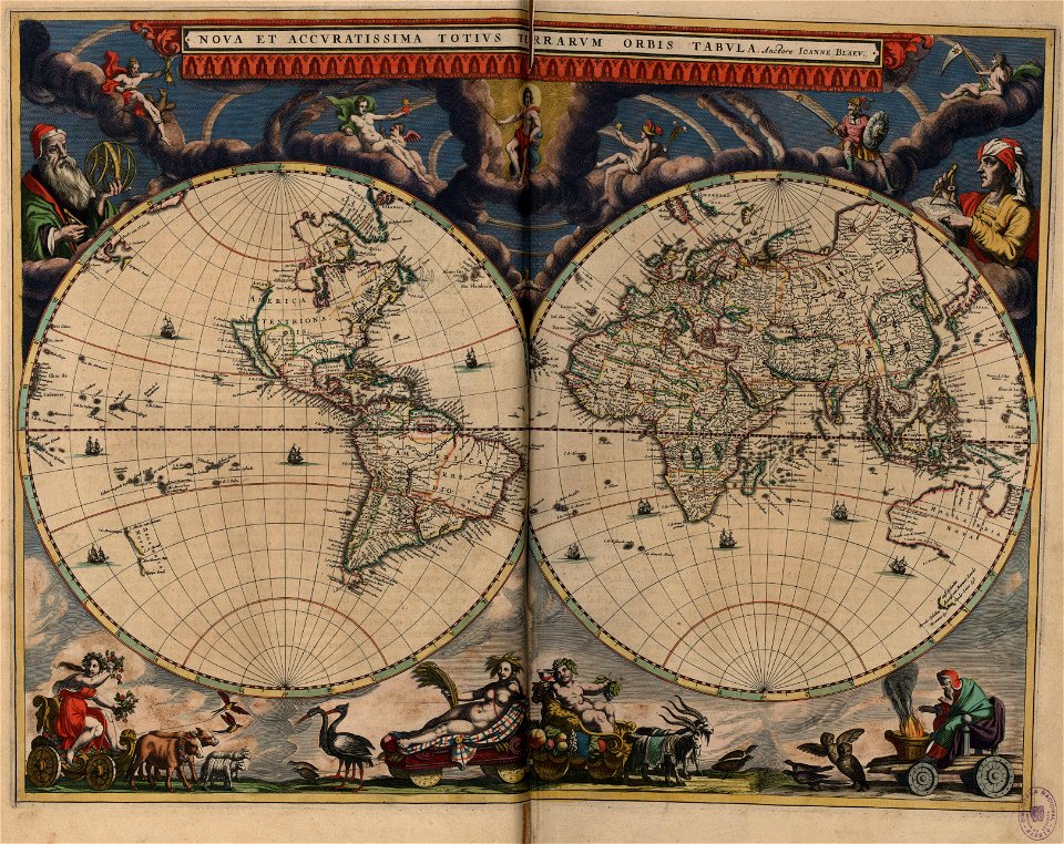
17th-century double hemisphere world maps
maps by pieter mortier
old maps of genoa
pocahontas (after simon van de passe - national portrait gallery, washington)
1616 engravings
brandenburg in the 17th century
engravings by matthäus merian
munich in the 17th century
thesaurus philopoliticus
old county maps of lancashire
copper engravings
atlas maior, vol 2 (sweden, russia, poland, eastern europe, and greece) - joan blaeu, 1667 - bl 114.h(star).2
17th-century maps of scandinavia
17th-century double hemisphere world maps
nuevo atlas o teatro mundo
madrid in the 1660s
louis meunier
atlas maior, vol 12 (america) - joan blaeu, 1667 - bl 114.h(star).12
1667 maps
atlas maior, vol 12 (america) - joan blaeu, 1667 - bl 114.h(star).12
1667 maps
atlas maior, vol 12 (america) - joan blaeu, 1667 - bl 114.h(star).12
1667 maps
17th-century prints in the national museum in warsaw
aegidius sadeler
atlas van der hagen (volume 4)
atlas van der hagen
amsterdam in the 17th century
copper engravings
old maps of the united states
copper engravings
copper engravings of german people
17th-century people of germany
copper engravings in the universitätsbibliothek salzburg
baroque
willem schouten
willem blaeu
jeremias falck
baroque
1660s maps of spain
1667 maps
history of marienplatz (münchen)
matthäus merian der jüngere
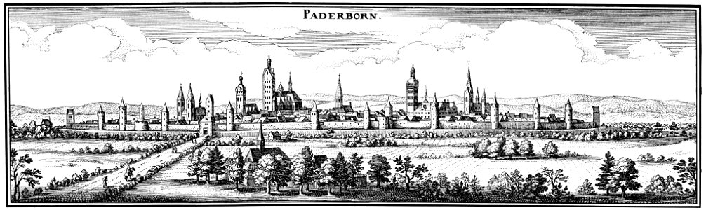
historic views of paderborn
baroque
old county maps of lancashire
copper engravings
atlas van der hagen (volume 4)
atlas van der hagen
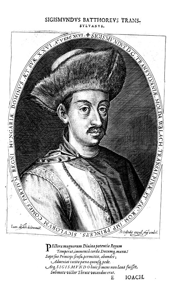
17th-century engraved oval portraits of men at bust length by dominicus custos
portraits of sigismund báthory
copper engravings in the universitätsbibliothek salzburg
baroque
copper engravings in the universitätsbibliothek salzburg
baroque
jesus college, oxford in art
loggan's oxonia illustrata
bruges in the 17th century
thesaurus philopoliticus
1600s maps of the netherlands
1609 maps of europe
maps in the library of congress
adriaen van der donck
atlas maior, vol 5 (england) - joan blaeu, 1667 - bl 114.h(star).5
17th-century maps of northamptonshire
atlas maior, vol 5 (england) - joan blaeu, 1667 - bl 114.h(star).5
17th-century maps of lancashire
atlas maior, vol 5 (england) - joan blaeu, 1667 - bl 114.h(star).5
17th-century maps of radnorshire
atlas maior, vol 5 (england) - joan blaeu, 1667 - bl 114.h(star).5
17th-century maps of leicestershire
atlas maior, vol 7 (france i) - joan blaeu, 1667 - bl 114.h(star).7
1667 maps
atlas maior, vol 5 (england) - joan blaeu, 1667 - bl 114.h(star).5
17th-century maps of brecknockshire
atlas maior, vol 5 (england) - joan blaeu, 1667 - bl 114.h(star).5
17th-century maps of staffordshire
atlas maior, vol 5 (england) - joan blaeu, 1667 - bl 114.h(star).5
17th-century maps of yorkshire
atlas maior, vol 5 (england) - joan blaeu, 1667 - bl 114.h(star).5
17th-century maps of glamorgan
atlas maior, vol 9 (italy) - joan blaeu, 1667 - bl 114.h(star).9
1667 maps of italy
atlas maior, vol 12 (america) - joan blaeu, 1667 - bl 114.h(star).12
1667 maps
atlas maior, vol 5 (england) - joan blaeu, 1667 - bl 114.h(star).5
17th-century maps of monmouthshire
atlas maior, vol 5 (england) - joan blaeu, 1667 - bl 114.h(star).5
17th-century maps of northumberland
atlas maior, vol 5 (england) - joan blaeu, 1667 - bl 114.h(star).5
17th-century maps of middlesex
atlas maior, vol 5 (england) - joan blaeu, 1667 - bl 114.h(star).5
17th-century maps of hertfordshire
atlas maior, vol 5 (england) - joan blaeu, 1667 - bl 114.h(star).5
17th-century maps of shropshire
atlas maior, vol 5 (england) - joan blaeu, 1667 - bl 114.h(star).5
17th-century maps of derbyshire
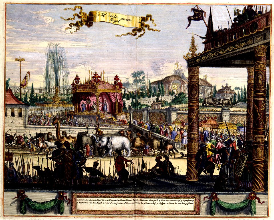
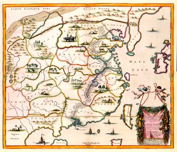
atlas maior, vol 11 (asia) - joan blaeu, 1667 - bl 114.h(star).11
1667 maps
atlas maior, vol 5 (england) - joan blaeu, 1667 - bl 114.h(star).5
17th-century maps of herefordshire
atlas maior, vol 5 (england) - joan blaeu, 1667 - bl 114.h(star).5
17th-century maps of huntingdonshire
atlas maior, vol 5 (england) - joan blaeu, 1667 - bl 114.h(star).5
17th-century maps of cambridgeshire
atlas maior, vol 5 (england) - joan blaeu, 1667 - bl 114.h(star).5
17th-century maps of nottinghamshire
atlas maior, vol 5 (england) - joan blaeu, 1667 - bl 114.h(star).5
17th-century maps of oxfordshire
atlas maior, vol 12 (america) - joan blaeu, 1667 - bl 114.h(star).12
1667 maps
atlas maior, vol 5 (england) - joan blaeu, 1667 - bl 114.h(star).5
17th-century maps of somerset
atlas maior, vol 5 (england) - joan blaeu, 1667 - bl 114.h(star).5
old maps of the channel islands
atlas maior, vol 12 (america) - joan blaeu, 1667 - bl 114.h(star).12
1667 maps
201 - 300 of 453
Next page
/ 5